


The municipality of Zamora covers an area of 149.28 km². Zamora is the capital of the province of Zamora, which belongs to the region Castile and León. It’s located in the Northern Plateau of the Iberian Peninsula; however, it’s the provincial capital with the lowest altitude in these highlands.
Zamora is located on the middle reaches of the Douro River. This river flows throughout the Northern Plateau in Castile, which is located north of the Central Mountain Chain, in the north-eastern Iberian Peninsula. The Northern Plateau is part of the huge elevated Inner Plateau that covers the central area of the peninsula.

If you’re planning to drive to Zamora, you can use the highway A-66 that connects Zamora to Benavente, where you can take the main roads to the North of the country (A-52 to Ourense, A-6 to A Coruña, and A-66 to Asturias). A-66, also called the «Silver Route» because of its Roman origin, connects Zamora to Salamanca too, which is only 64 km away.
If you choose the highway A-11, you can find in the stretch between Zamora and Tordesillas (in Valladolid) two important highways: the A-6 to Madrid and the A-1 to the Basque Country.
The road N-631, which goes from Zamora to Puebla de Sanabria, has a connection to the highway A-52 to Ourense and the road N-122 to Bragança, in Portugal.
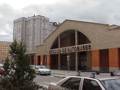
Different companies offer national and international bus services from Zamora. The bus station is on Alfonso Peña Avenue.
The company Avanza Bus offers direct journeys to Madrid daily as well as to other towns in Castile and León. ALSA provides bus trips to Barcelona, Oviedo, and Gijón.
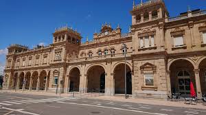
Zamora railway station is on Carretera de la Estación and offers transport to other provinces constantly. There are two trains from Zamora to Madrid every day. Alicante is the final destination of one of the trains on Saturday. Train schedules and destinations are available on RENFE‘s website.